

Water Level and The Old Dam Tower (co-ord : 53.52049, -1.77115)
Winscar Reservoir is primarily used as a compensation reservoir on the headwaters of the River Don in South Yorkshire, managed by Yorkshire Water. Its main job is to release controlled amounts of water into the River Don downstream to maintain healthy river flows and support local ecology, industry, and water levels during drier periods. As such the water level can vary quite widely depending on the time of year.
You can find out more information about the current water level here.
When the Winscar water level at drops significantly an old structure can become a hazard on the water.
First a quick history lesson to explain why it exists....Dunford Bridge Dam was built in the 1850s and was used to supply water for the River Don and to towns in the Spen Valley. The height of Dunford Bridge dam was 1,100 feet (340 m), which is some 35 feet (11 m) lower than the present Winscar Reservoir. The current dam was built in the period 1972-1975 subsuming the original dam to significantly increase the capacity and create Winscar Reservoir, as is now.
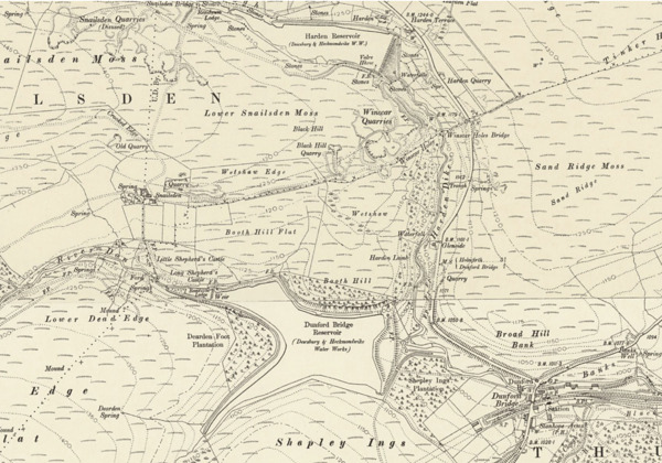
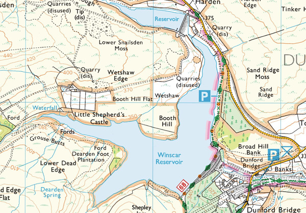
The maps below using the same scale and covering the same area show the difference between the 2 reservoirs.
|
|
| Original Dunford Bridge Reservoir | Winscar Reservoir |
The original Dunford Bridge Dam has a tower at the far end of it and when the water level drops by circa 9m this broaches the surface and becomes visible.
The tower should be considered a hazard if the water level drops 7m as measured against the graduated marks below the building next to the dam overflow and will be visible if it drops 9m.
The tower is south east of the headland of Booth Hill (opposite the club house) in the vicinity of mark E at co-ordinates 53.52049, -1.77115.
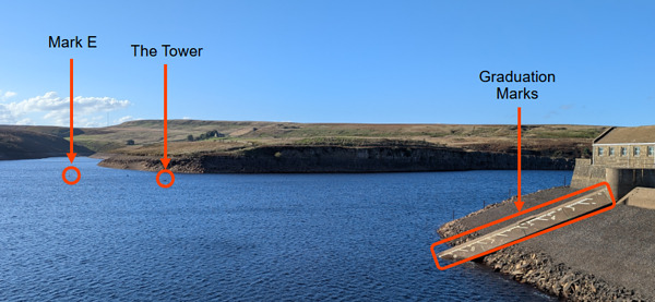
View from the dam wall looking WNW with mark E, the top of the tower and the graduated marks all highlighted
Last updated 5:29pm on 13 October 2026